Hill crest
The controlled 120 m crest interrupts the intended geometric sightline.
Anonymous frozen demo · DEMO-DRONE-01
Inspect a five-point, two-observer synthetic route with a controlled hill obstruction, partial source coverage, a NoData area and synthetic airspace context.
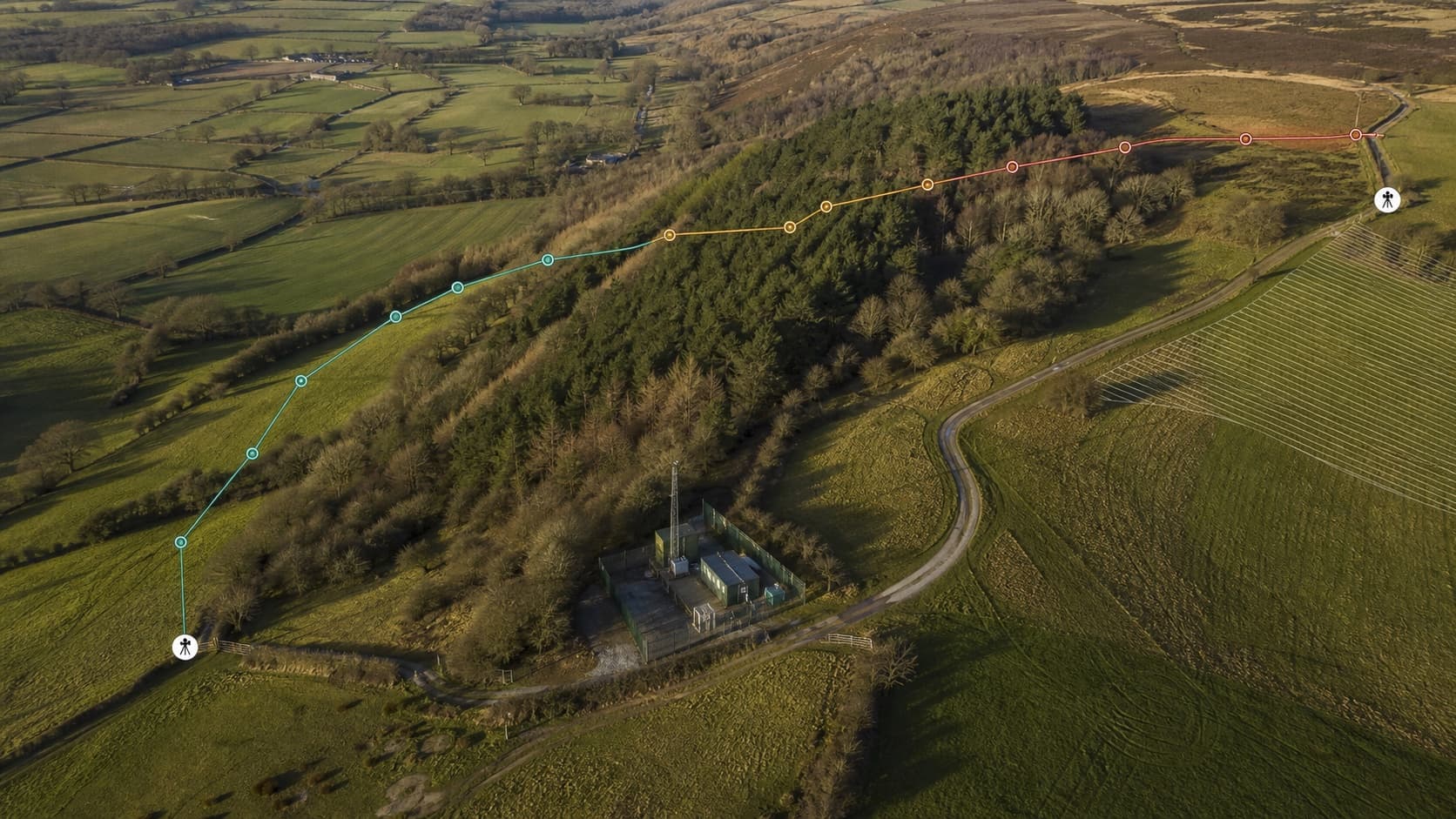
Terrain relief and changing route confidence remain visible in one professional planning view.
These states are assertions in the repository fixture package. They demonstrate the intended product contract; they do not describe a proposed real flight.
The controlled 120 m crest interrupts the intended geometric sightline.
The missing terrain area remains unknown and is not replaced by zero elevation.
The route crosses a synthetic area that requires review; it is not official airspace.
The scene is exact synthetic evidence, not an independently surveyed operational site.
| Source | Publisher | Grade / type | Resolution | Datum | Health |
|---|---|---|---|---|---|
| fixture-terrain-surface-v1 | SighThor test fixtures | Preview · synthetic DTM/DSM | 1 m | SYNTHETIC-AMSL | current |
| fixture-airspace-v1 | SighThor test fixtures | Preview · synthetic polygon and vertical limits | 1 m | SYNTHETIC-AMSL | current |
The UK origin helps make the example legible, but every finding is generated from a local synthetic scene.